
The Science Content Standards for Grades Six Through Eight
In each grade, kindergarten through grade five, the science content
standards cover the areas of physical, life, and earth sciences in approximately equal measures. In each of the middle grades, however, the content standards emphasize an individual area. This organization permits students to probe each area in greater depth.
-
• In grade six the content standards focus on earth sciences. Students of-ten become environmentally aware at this grade level, and this focus is meant to stimulate intellectual curiosity in that area.
-
• In grade seven the content standards focus on life sciences. Students at this grade level typically receive a semester of health education, and this focus is designed both to complement that instruction and to prepare students for the biology/life sciences course work that is often taken in the early high school years.
-
• In grade eight the content standards focus on physical sciences. This focus is designed to prepare students for the physics and chemistry course work that is often taken in the later high school years.
In all three of the middle grades, science instruction is intended to pro-vide students with a solid foundation for the more formal treatment of concepts, principles, and theories called for at the high school level.
Not all students will enter middle school prepared for the rigorous science curriculum called for in the middle grades standards. Teachers should use “catch up” strategies to ensure that students are prepared for high school science. One of the key requirements is for students to have foundational reading and mathematics skills, as outlined in the State Board of Education’s Reading/Language Arts Framework for California Public Schools and the Mathematics Framework for California Public Schools.1 Those frameworks provide specific strategies for teachers to help students who are below grade level in reading and mathematics.
Students who are prepared to undertake the study of algebra (either as a separate course or as part of an integrated mathematics course) in grade eight, as called for in the Mathematics Content Standards for California Public Schools, will be on the pathway for success in high school science.2 Those who are not as well prepared will struggle and may even fail in their science classes to the great frustration of their teachers and parents/guardians. For example, students who have not mastered arithmetic and algebra skills will find chemistry difficult, if not
impossible. Science instruction should provide opportunities for students to use mathematics by solving problems. Teachers may use science to both rein-force mathematical abilities and deepen students’ understanding of key mathematical concepts.
Safety is always the foremost consideration in the design of demonstrations, hands-on activities, laboratories, and science projects on site or away from school. Teachers must become familiar with the Science Safety Hand-book for California Public Schools.3 It contains specific and useful information relevant to classroom teachers of science. School administrators, teachers, parents/guardians, and students have a legal and moral obligation to promote safety in science education. Safety should be taught. Scientists and engineers in universities and industries are required to follow strict environmental health and safety regulations. Knowing and following safe practices in science are a part of understanding the nature of science and scientific enterprise.
The Science Content Standards for Grades Six Through Eight
Chapter 4
The Science Content Standards for Grades Six Through Eight

Grade Six
The science curriculum in grade six emphasizes the study of earth sciences. Students at this age are increasing their awareness of the environment and are ready to learn more. The standards in grade six present many of the foundations of geology and geophysics, including plate tectonics and earth structure, topography, and energy. The material is linked to resource management and ecology, building on what students have learned in previous grades. Unless students take a high school earth science class, what they learn in grade six will be their foundation for earth science literacy.
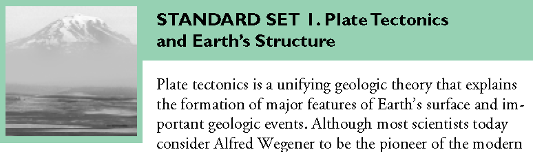
continental drift theory, he died with very little recognition for his accomplishment. Wegener asserted that evidence on Earth’s surface indicated that the continents were once attached as an entire land mass. He theorized that this land mass broke up into pieces that subsequently drifted apart. Today, geologists know that plate tectonic processes are responsible for most of the major features of Earth’s crust (including continental configuration, mountains, island arcs, and ocean floor topography) and are an important contributor to the recycling of material in the rock cycle. Driven by the flow of heat and material within Earth, these processes cause stresses in Earth’s crust that are released through earthquakes and volcanic activity. Mountain building counters the constant destructive effects of weathering and erosion that eventually wear down Earth’s surface features.
Evidence of past plate tectonic movement is recorded in Earth’s crustal rocks, in the topography of the continents, and in the topography and age of the ocean floor. Continental edges reflect that they were once part of a single large supercontinent that Wegener named Pangaea. Upon the breakup of this supercontinent, the
individual continents were moved to their present locations by the forces that drive plate tectonics. When the continental plates of today are returned to their super-continent positions (through computer modeling), the fossil and sedimentary evidence of ancient life distributions and climate becomes coherent, providing strong support for the existence of Pangaea. As plates move in relation to one another, landforms and topographic features, such as volcanoes, mountains, valleys, ocean trenches, and midocean ridges, are generated along plate boundaries. Those regions are also frequently associated with geothermal and seismic activity. There is strong evidence that the divergence and convergence of the lithospheric plates did not begin and end with Pangaea but have been going on continually for most of the history of Earth.
Students should read and discuss expository texts that explain the process of continental drift and study maps that show the gradual movement of land masses over millions of years. Students may then model the process by cutting out continental shapes from a map of Earth and treating these continents as movable jigsaw puzzle pieces. Students read about the underlying evidence for continental drift and determine that the best-supported model of Pangaea shows a continuation of major geologic features and fossil trends across continental margins. The “broken” pieces of Pangaea can be gradually moved into their modern-day continental and oceanic locations. In doing this students should think carefully about the rate and time scale of the movement. This would be a good point in the curriculum to introduce the differing compositions of the denser ocean floor (basaltic) rock and less-dense continental (granitic) rocks. Students can also learn why most modern-day earth-quakes and volcanoes occur at the “leading edges” of the moving continents.
-
1. b. Students know Earth is composed of several layers: a cold, brittle lithosphere; a hot, convecting mantle; and a dense, metallic core.
Earth is not homogeneous solid rock but is composed of three distinct layers: a rocky, thin, fractured outer layer called the crust; a denser and thick middle layer called the mantle; and a dense, metallic center called the core. Geologists also use another classification scheme in which the outer, brittle layer of Earth is called the lithosphere (from the Greek lithos for rock). The lithosphere includes the crust and the outermost portion of the mantle and is the part that is broken into the tectonic plates. Students should know the properties of the crust, mantle, core, lithosphere, and plastic mantle region just beneath the lithosphere called the asthenosphere.
Temperature increases with increasing depth as a consequence of the heat re-leased by the decay of trace quantities of radioactive atoms that are contained within Earth. Heating lowers the density of parts of the interior. Because an arrangement of high-density material over low-density material cannot be gravitationally stable, a vertical flow called convection develops. This convection can be sustained as long as the interior continues to be heated, causing a continuous cycling within Earth’s interior. Scientists gather evidence for the details of Earth’s layered structure from the analysis of seismic P and S waves as they pass through the planet. The content of this standard can be learned efficiently by the study of a
The Science Content Standards for Grades Six Through Eight
Grade Six
Focus on Earth Sciences
Chapter 4
The Science Content Standards for Grades Six Through Eight
Grade Six
Focus on Earth Sciences
cross-sectional model or diagram of Earth showing locations (to scale) of the crust, mantle, and core with each subdivision labeled according to temperature, density, composition, and physical state.
-
1. c. Students know lithospheric plates the size of continents and oceans move at rates of centimeters per year in response to movements in the mantle.
Convective flow in the mantle moves at rates measured in centimeters per year, about as fast as fingernails grow. Mantle motion is transferred to the lithosphere at its boundary with the asthenosphere. As a result of this coupling, the lithospheric plates are carried passively along, riding as “passengers” at the same slow rate, in much the same way that ice floats along on slow-moving water. These lithospheric plates may be oceanic (i.e., they consist of rocks of basaltic composition) or continental (i.e., they consist of a more varied suite of rocks, mostly of granitic composition, covered in many places with a thin veneer of sedimentary rocks). Convective flow is based on the “rising” and “sinking” of materials with different relative densities. Just as a hot-air balloon rises through lower temperature and therefore denser air, hot convecting mantle can rise through lower temperature and therefore denser rock, albeit very slowly. When the material cools and increases in density, it may sink just like the hot-air balloon once the air inside has cooled. Oceanic lithosphere cools after it forms at Earth’s surface and can eventually become dense enough that it will sink into Earth’s interior, sliding under an adjacent plate that is less dense.
-
1. d. Students know that earthquakes are sudden motions along breaks in the crust called faults and that volcanoes and fissures are locations where magma reaches the surface.
The hot, moving mantle is responsible for many geologic events, including most seismic and volcanic activity. As a result of the relative motion of the lithospheric plates, the boundaries of the plates are subjected to stresses. When the rocks are strained so much that they can no longer stretch or flow, they may rupture. This rupture is manifested as sudden movement along a broken surface and is called a fault. The energy released is spread as complex waves (called earthquakes) that travel through and around Earth. Volcanic phenomena, including explosive eruptions and lava flows, may also result from interactions at the boundaries be-tween plates. Molten gas-charged magma generated in the crust or mantle rises buoyantly and exerts an upward force on Earth’s surface. If these rocks and gases punch through the surface, they result in a variety of volcanic phenomena.
Using California-adopted texts, software, and other instructional materials aligned with the Science Content Standards, students can study models of the inner structures of volcanoes, the dynamics of the central crater, and the processes of erupting and flowing lava. Students can study the various types of volcanoes and how they form. They can also learn about different types of lava flows and the three major types of volcanic landforms (cone, shield, and composite).
-
1. e. Students know major geologic events, such as earthquakes, volcanic eruptions, and mountain building, result from plate motions.
Most (but not all) earthquakes and volcanic eruptions occur along plate boundaries where the plates are moving relative to one another. The movement is never smooth; it may produce fractures or faults and may also generate heat. The sudden shift of one plate on another plate along faults causes earthquakes. Volcanic eruptions may occur along faults in which one plate slides under another and sinks deep enough to melt part of the descending material. This process of one plate sliding under another is called subduction. Great mountain-building episodes occur when two continental plates collide. The collision (although slow) is enormously powerful because of the mass of the continents. Over long periods of time, this process may crumple and push up the margins of the colliding continents.
Students may use a large map of the world or of the Pacific Ocean (including the entire Pacific Ocean Rim) to plot the locations of major earthquakes and volcanic eruptions during the past ten to 100 years. The locations of those tectonic events may be found on the Internet or in various library resources. Different symbols may be used to represent different depths or magnitudes of events. In studying such a map, students should note that tectonic events form a “ring” that outlines the Pacific Plate and that there is a Hawaiian “hot spot.” Landforms associated with the plate boundaries include mountain belts, deep ocean trenches, and volcanic island arcs.
-
1. f. Students know how to explain major features of California geology (including mountains, faults, volcanoes) in terms of plate tectonics.
Most of California resides on the North American lithospheric (continental) plate, one of the several major plates, and many smaller plates that together form the lithosphere of Earth. A small part of California, west of the San Andreas Fault, lies on the adjacent Pacific (oceanic) Plate. Geologic interactions between these two plates over time have created the complex pattern of mountain belts and intervening large valleys that make up the current California landscape. Large parts of the central and southern parts of California were once covered by a shallow sea. Inter-actions with the Pacific Plate during the past few million years have compressed, fractured, and uplifted the area. This tectonic deformation has buckled the lithosphere upward to create the high-standing coastal and transverse mountain ranges and downward to form the lower-lying Central Valley, Los Angeles Basin, and Ventura Basin.
The Science Content Standards for Grades Six Through Eight
Grade Six
Focus on Earth Sciences
Chapter 4
The Science Content Standards for Grades Six Through Eight
Grade Six
Focus on Earth Sciences
-
1. g. Students know how to determine the epicenter of an earthquake and know that the effects of an earthquake on any region vary, depending on the size of the earthquake, the distance of the region from the epicenter, the local geology, and the type of construction in the region.
An epicenter is that point on Earth’s surface directly above the place of an earthquake’s first movement, or focus. It is located by seismic data recorded at a minimum of three seismograph stations. The method of locating the epicenter is based on the speed of seismic waves that travel through the ground—seen as their relative times of arrival at seismic stations. These vibrations are called P-and S-waves. P-, or primary, waves are compressional with particle motion in the same direction as the wave propagation. S-, or secondary, waves are shearing with particle motion perpendicular to the direction of wave propagation. S-waves travel at about 60 percent of the speed of P-waves.
The motion of P-and S-waves and the difference in their respective velocities are easily modeled with a long and flexible spring (typically sold as a toy). Compressing and releasing a few coils at the end of the spring stretched between two students generates visible P-waves that travel the length of the spring and back in the opposite direction. Slapping the side of the spring generates S-waves that travel as sideways displacements down the length of the spring. If students measure the distance between the ends of the spring and the time it takes for the P-and S-waves to travel the full length, they can calculate the different velocities of the two waves along the spring.
Seismographs record the arrival time of the P-and S-waves. The knowledge that both waves started at the same time allows one to determine the distance of the epicenter. If three or more seismographs record distances to the same event, the epicenter of the earthquake may be determined by triangulation.
Students in grade six can be taught to locate epicenters if they are given the arrival times at various locations on a map, along with a simple velocity model. They may also be asked to locate major geologic features in and near California, such as Mount Lassen, the San Andreas Fault, the Sierra Nevada ranges, Death Valley, the Baja Peninsula, and the San Francisco Peninsula. They can draw and relate these to a map that includes outlines of the major tectonic plates. California’s population is primarily concentrated near the San Andreas Fault and the system of faults that surround it. Students can plot on a map the location of their school and nearby active faults and research records of earthquake activity, ground motion, and fracturing.
Seismograph stations also record the amplitude of the ground motion, which can be used to calculate the magnitude of an earthquake (a relative measure of the amount of energy released). Magnitude is often reported according to the Richter scale, with values that generally range from around 0 to a little less than 9. Each increase of one number in magnitude represents a tenfold increase in ground shaking. Geologists may also investigate the effects of an earthquake on structures (and people’s reactions) and assign an intensity value to that earthquake. The intensity
values are then plotted on a map to give a more complete picture of the earth-quake’s effects. There are several different intensity scales, but the one most widely used in this country is the Modified Mercalli scale. This scale ranges from I (not felt) to XII (damage nearly total).
The magnitude of an earthquake is determined by the buildup of elastic strain (stored energy) in the crust at the place where ruptures (faults) may eventually occur. Unfortunately, many small earthquakes combined can release only a small fraction of the stored energy. For example, it might take as many as one million earthquakes, each at a magnitude of 4.0 on the Richter scale to release the same amount of energy as a single earthquake at 8.0. Although each increase of one number on the Richter scale reflects a tenfold increase in ground shaking, it represents nearly a thirtyfold increase in energy released. Therefore there is always a possibility that a large, destructive earthquake will release most of the stored energy. Because the materials through which earthquakes move can absorb energy and because the energy is spread over a wider area as its waves propagate outward, an earthquake tends to weaken with increasing distance from its epicenter. As earthquake waves pass through the ground, unconsolidated materials, such as loose sediments or fill, tend to shake more violently or undergo liquefaction more easily than do harder materials. Buildings made of brittle materials (e.g., reinforced concrete, brick, or adobe) tend to suffer greater earthquake damage than do those made of more flexible materials (wood). Taller buildings are often more susceptible to earthquake damage than are single story-buildings.
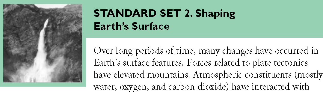
minerals and rocks at Earth’s surface, weakening them and breaking them down through a process called chemical weathering. Physical processes involving, for ex-ample, the growth of plants, the release of pressure as overlying material is eroded, and the repeated freezing and thawing of water in cracks, have also helped to break down rocks. Fragments are transported downslope by wind, water, and ice. Gravity by itself moves material by way of landslides and slumps (called mass wasting). The ultimate destination of most of the products of weathering is the ocean. These products arrive in the form of marine sediment deposits. In time the mountains are laid low, the rivers change their courses and disappear, and lakes and seas expand or dry up. Eventually sediments, which have found their way to the oceans along continental margins, are compacted and changed to rock, then uplifted by continental collision or subducted and melted under the crust. New mountains are formed, and the cycle (called the geologic cycle) begins anew. Each cycle takes tens of millions of years.
The Science Content Standards for Grades Six Through Eight
Grade Six
Focus on Earth Sciences
Chapter 4
The Science Content Standards for Grades Six Through Eight
Grade Six
Focus on Earth Sciences
Water contributes to two processes that help shape the landscape—the break-down of rock into smaller pieces by mechanical and chemical weathering and the removal of rock and soil by erosion. Water is the primary agent in shaping California’s landscape. Surface water flow, glaciers, wind, and ocean waves have all been and continue to be active throughout California and the rest of the world in shaping landscapes.
A “stream table” may be used to demonstrate the effectiveness of running water as an erosion agent. Stream tables can be easily made from plastic bins or dishpans filled with sand or gravel. The water source may be a hose, a siphon that draws from a cup, or even a drip system. Students may use either gradient or water flow rate as the independent variable. Rates of settling of different sizes of sediment through water may be demonstrated through the use of a sediment jar.
-
2. b. Students know rivers and streams are dynamic systems that erode, transport sediment, change course, and flood their banks in natural and recurring patterns.
The energy of flowing water is great enough to pick up and carry sediment, thereby lowering mountains and cutting valleys. Sediment carried by a stream may be directed against solid rock with such force that it will cut or abrade the rock. The steeper the slope and the greater the volume-flow of water, the more energy the stream has to erode the land. The flow of water usually varies seasonally. At times of heavy rainfall in a watershed, a stream may flood and overflow its banks as the volume of water exceeds its containment capacity. Flooding may cause a stream to change its path. A stream bank, which consists of sediment or bedrock, may collapse and change the water’s course. One example of this is a stream’s tendency to shorten its length by forming oxbow lakes. This redirection of the stream’s course usually takes place in natural and recurring patterns year after year.
-
2. c. Students know beaches are dynamic systems in which the sand is sup-plied by rivers and moved along the coast by the action of waves.
The final destination of sediment is usually the ocean. Coarse sediment (sand size and larger) frequently is temporarily trapped along the shore as beach deposits while the finest sediments are often washed directly out to sea and, in some cases, carried by ocean currents for many miles. Waves that break at oblique angles to the shore move sediment along the coast. Waves wash the sand parallel to the direction in which they break, but the return water-flow brings sand directly down the slope of the beach, resulting in a zigzag movement of the sand. Students can observe
differences in sand (e.g., size, color, shape, and composition) by using sand collections that may be obtained from various sources, including family and friends. The differences result from the variety of rock sources from which the sand has come, the weathering processes to which the rock has been subjected, and the completeness of the weathering (i.e., how long the rock has been subjected to weathering).
Students should attempt to identify any minerals or rocks that would indicate the kinds of weathered materials contained in the sand. Students examining sand from California beaches will find constituents such as quartz, feldspar, shell fragments, and magnetite. Magnetite is fun to extract by passing a magnet, wrapped in a plastic bag, through the sand. Magnetite may be saved and later used in place of iron filings to demonstrate magnetic field geometry for another standard.
-
2. d. Students know earthquakes, volcanic eruptions, landslides, and floods change human and wildlife habitats.
Earthquakes can collapse structures, start fires, generate damaging tsunamis, and trigger landslides. Landslides can destroy habitats by carrying away plants and animals or by burying a habitat. Volcanic eruptions can bury habitats under lava or volcanic ash, ignite fires, and harm air quality with hot toxic gases. Floods can bury or wash away habitats.
Lives may be lost and property damaged when humans get in the way of those powerful natural processes. Although construction (and human habitation) in areas prone to natural disasters is often impossible to avoid, understanding the likelihood of such disasters and taking steps to mitigate the potential effects would be wise. Moreover, no construction too close to known hazards (e.g., on floodplains) would be advisable. Certainly, the frequency (probability) and severity of flooding, land-slides, and earthquakes must be considered when one decides on land use. Making those decisions should be done after consideration of many factors, including the use of scientific evidence to predict catastrophic events and the local impacts. Although catastrophic events are usually adverse in the short term, some of them may be beneficial in the long term. For example, river floods may deliver new, nutrient-enriched soil for agriculture. Other catastrophic changes may introduce new habitats, allow fresh minerals to surface, change climates, or give rise to new species.
The Science Content Standards for Grades Six Through Eight
Grade Six
Focus on Earth Sciences
belief that an object became hot when it was permeated by a large quantity of caloric and cooled when some of its caloric flowed into other objects that had less
Chapter 4
The Science Content Standards for Grades Six Through Eight
Grade Six
Focus on Earth Sciences
caloric. This model was upset by the work of two scientists: Benjamin Thompson (later known as Count Rumford) and James Joule. Rumford supervised the boring of cannons. He noted that the water kept in the bores to prevent overheating boiled continuously. This boiling was supposedly caused by the caloric that flowed from the metal of the cannon as it was cut.
From his observations, however, Rumford deduced that this explanation could not be correct because the boiling continued even when the boring tool became so dull that it no longer had any effect on the metal. Apparently, the caloric was being produced out of nothing. Rumford concluded that it was the work needed to turn the dull tool, instead of caloric transfer, that was being converted into heat. In a series of experiments, Joule showed that a given amount of mechanical work always produced the same amount of heat no matter what kind of mechanical work was done. This demonstration established that heat is indeed a form of energy. Today, it is known that heat is energy contained in the random motion of atoms and molecules and that to heat an object is to increase the energy so stored.
Although students will not be exposed to kinetic molecular theory until high school, teachers who understand the following points will be better able to discuss the subjects of heat and heat transfer. The transfer of heat from a warmer object to a colder object is referred to as heat flow. Heat may be transferred by conduction, convection, or radiation. Standard Sets 3 and 4 in grade six deal in depth with the relationships between heat and convection in Earth’s mantle, oceans, and atmosphere. Material covered in those standards will build a foundation for the study of heat. Students will learn that atoms are free to move in different ways in solids, liquids, and gases and that heat may be given off or absorbed during chemical reactions. The concept that heat is a form of energy associated with the motion of at-oms and molecules is covered in high school. Students in grade six will study the relationship between work and heat flow and will be required to solve problems related to this subject.
Energy is transferred from one object to another as the result of a difference in temperature. Heat flow is the transfer of energy from a warmer object to a cooler object.
A wave is an oscillating disturbance that carries energy from one place to an-other without a net movement of matter. For example, sound waves from one vibrating object can cause other objects, such as eardrums, to vibrate. Electromagnetic waves can also carry energy. One example of this phenomenon is the transfer of heat from the Sun to Earth. Students may think of the infrared radiation escaping from a bed of hot coals and warming their hands as another example of heat flow.
Energy can also be transferred by the movement of matter. For example, the energy supplied by the pitcher’s arm transports a pitched baseball to the catcher’s mitt.
-
3. b. Students know that when fuel is consumed, most of the energy released becomes heat energy.
When fuel is burned, energy stored in the fuel’s chemical bonds is released as heat and light. Only a small portion of the energy contained in the original fuel remains locked in the waste products left over after the fuel has been consumed. Although the heat derived from fuels is often used in turn to drive engines that perform useful work, an important understanding is that even the work performed ultimately tends to be transformed into heat. For example, an automobile set into motion and braked to rest transforms most of its kinetic energy into heating the brake pads by friction. As a demonstration the teacher might light a candle in the classroom and let students know that the wax in the candle is the fuel that combines with oxygen in the air to produce both heat and light. Most of the heat is transferred to the room by the hot gases rising from the flame. Glowing particles of soot (the source of the yellow light) also transfer energy from the flame. Students might be asked to develop an explanation of how heat is transferred from the burning fuel to a container of water heated by the candle, using the concepts and principles called for in this standard set.
-
3. c. Students know heat flows in solids by conduction (which involves no flow of matter) and in fluids by conduction and by convection (which involves flow of matter).
This standard focuses on differences between heat transfer by conduction and by convection and begins to build an understanding of the kinetic molecular theory of heat transfer. In both solids and fluids (liquids and gases), heat transfer is measured by changes in temperature.
Conduction occurs when a group of atoms or molecules whose average kinetic energy is greater than that of another group transfers some of that excess energy by means of collisions. Because hot objects have atoms with greater average kinetic energy than do cold ones, there is a transfer of this kinetic energy from hot to cold. In a solid the atoms vibrate in place, but energy may still be transferred from atom to atom as happens when a pan is placed on a stove and its handle becomes hot. The same mechanism describes the conduction of heat in liquids and gases, where the atoms are free to slip past one another provided there is no cumulative flow in the material. To demonstrate conduction a teacher might wrap some paper (to form a handle) around the end of a metal rod about 30 centimeters long and use paraffin to attach a series of thumbtacks, spaced about two centimeters apart, along the rod. The teacher then holds the rod by the handle and places the free end over a candle or in a burner flame. As heat is conducted along the rod, the tacks drop away one by one.
The Science Content Standards for Grades Six Through Eight
Grade Six
Focus on Earth Sciences
Chapter 4
The Science Content Standards for Grades Six Through Eight
Grade Six
Focus on Earth Sciences
Convection occurs because most fluids become less dense when heated; the hot fluid will rise through cold fluid because of the hot fluid’s greater buoyancy. As hot fluid arises away from a heat source, it may cool, become denser, and sink back to the source to be warmed again. The resulting circulation is called a convection current. Convection currents account for the water in a kettle reaching a uniform temperature although the kettle is warmed only at the bottom. The effects of convection may be investigated by placing finely shredded paper into a large heat-resistant beaker or roasting pan filled with cold water. After the paper is saturated and sinks to the bottom of the container, the teacher may apply heat from a hot plate and note that the paper particles move upward near the heat source and downward away from it.
-
3. d. Students know heat energy is also transferred between objects by radiation (radiation can travel through space).
Another form of energy transfer between objects is radiation: the emission and absorption of electromagnetic waves. Radiation is fundamentally different from conduction and convection in that the objects do not have to be in contact with each other or be joined by a solid or fluid material. Heating by sunlight is an obvious example of radiant energy transfer. Both the heat and the light that can be seen are forms of electromagnetic radiation. Calling attention to this fact may help dispel the common misconception that all radiation is harmful.
visible light, most of this incoming energy is transferred to Earth’s surface. Conductive transfer and reradiation of this energy heat the lower atmosphere and result in convection currents that distribute the heat into the atmosphere.
Solar radiation heats Earth’s surface unevenly, resulting in thermal gradients in the atmosphere. Variations in the angle of sunlight influence the amount of energy reaching each square meter of Earth’s surface and largely account for the uneven heating of the surface. The angle of sunlight varies because of Earth’s spherical shape and because the Sun’s rays travel in a straight line parallel to one another. If a surface area of this planet is directly perpendicular to the Sun (meaning the Sun is directly overhead), then the rays strike at a 90-degree angle, resulting in maximum absorption of solar radiation because the energy is concentrated on a relatively small area. As the surface curves away from this spot, the angle at which sunlight strikes it becomes smaller, and the same amount of solar radiation is spread over a broader area.
The uneven heating of Earth’s surface and the tilt of its axis (66.5 degrees to the orbital plane or 23.5 degrees to the perpendicular) account for the seasons and extremely cold north and south poles. Clouds and the varied reflectivity of Earth’s surface contribute to uneven heating. In general, however, the total solar energy transferred to Earth is nearly constant, and all the energy gains and losses are in balance. Consequently, Earth enjoys climates that are relatively stable for thousands of years, with predictable temperature ranges and weather patterns that can be broadly forecast.
Various heat exchange mechanisms operate in the Earth system. Ocean surface water is heated by the Sun and mixed by convection currents. The atmosphere ex-changes heat with the oceans and land masses by means of conduction. Warm air near Earth’s surface rises and cooler air descends, causing atmospheric convection currents. Different parts of the ocean have different temperatures and salinities, resulting in deep convection currents. The convection currents in the atmosphere move evaporated water away from ocean surfaces; from there the water vapor can be picked up by winds and carried to other locations where it may condense as precipitation. In this manner both heat and water are transported.
The observed patterns of surface winds are mostly the result of convection cur-rents caused by uneven surface heating. Winds are deflected by the Coriolis effect (caused by the west-to-east turning of Earth) and by topography. Latitude, winds (speed, direction, and moisture content), and the elevation of the land and its proximity to the ocean largely determine the climate and corresponding weather pat-terns in any particular region.
Earth’s crust contains localized concentrations of internal heat, as evidenced by volcanoes, hot springs, and geysers. However, the total amount of heat transferred to the atmosphere from Earth’s crust is minute compared with the amount of heat the surface receives from the Sun.
Radiation from the Sun penetrates the atmosphere by heating the air, the oceans, and the land. Solar radiation is also converted directly to stored energy in plants through photosynthesis. The Sun is a constant, close-to-uniform source of energy that is responsible for the climate and weather, drives the water cycle, and makes life possible on Earth.
-
4. b. Students know solar energy reaches Earth through radiation, mostly in the form of visible light.
A full-wavelength spectrum of electromagnetic energy is present in solar radiation from below the infrared to above the ultraviolet. However, most of the energy
The Science Content Standards for Grades Six Through Eight
Grade Six
Focus on Earth Sciences
Chapter 4
The Science Content Standards for Grades Six Through Eight
Grade Six
Focus on Earth Sciences
radiated by the Sun is in the visible or near visible part of the light spectrum, and that is largely the part that penetrates the transparent atmosphere and reaches Earth’s surface. Because blue light is scattered by the atmosphere more than yellow light, the sky looks blue and the Sun looks yellow. Students should understand that both long- and short-wavelength radiation may interact in various ways with atmospheric constituents and may be absorbed by atmospheric constituents in different amounts; however, the wavelengths of visible light are not greatly absorbed by any atmospheric constituent.
-
4. c. Students know heat from Earth’s interior reaches the surface primarily through convection.
Heat from the interior of Earth moves toward the cooler crustal surface. Rock is a poor conductor of heat; therefore, most of the transfer of heat occurs through convection. Convection currents in the mantle provide the power for plate tectonic movements. Heat reaching Earth’s surface in this manner is transferred to the atmosphere in relatively small amounts.
-
4. d. Students know convection currents distribute heat in the atmosphere and oceans.
Convection plays a central role in transferring heat energy from place to place in the atmosphere and ocean. Uneven heating of the land and ocean causes convection currents. This movement of air and water creates the wind and ocean currents that are deflected by the geography of the land and the rotation of Earth. Students can investigate atmospheric convection currents on a small scale by using a smoke chimney or fog chamber. In the absence of more sophisticated equipment, much can be observed about atmospheric convection by studying what happens to visible water droplets (condensing steam) as they exit a boiling teakettle.
There are several ways to investigate convection currents in a liquid. One way is to float a large ice cube (tinted with food coloring) on hot water and trace the resulting convection currents. Another way is to heat one end of an elongated cake pan full of water. Convection may be observed by adding drops of food coloring.
-
4. e. Students know differences in pressure, heat, air movement, and humidity result in changes of weather.
Changes in local temperatures, atmospheric pressure, wind, and humidity create the weather that everyone experiences. All those effects are connected directly to the processes associated with the transfer of solar energy to Earth and redistribution of that energy in the form of heat. Precipitation occurs when moist air is cooled below its condensation temperature (dew point).
Great currents circle the globe in the convecting atmosphere and ocean, created by atmospheric pressure and temperature gradients that, in turn, spin off local winds and eddies. Temperature differences also lead to changes in humidity and precipitation. The local set of these descriptive measures is called weather, and the
changes result in weather patterns. The long-term seasonal average of these weather patterns defines the climate of an area.
must constantly be renewed. Green plants are the foundation of the energy flow in most ecosystems because they are capable of producing their own food by photo-synthesis. Because energy is either used by consumers or depleted in a logical progression, it can be said to flow through a food web (also known as a food chain). A food web may be represented as an energy pyramid with green plants as a base, midlevel consumers in the middle, and a few top-level predators at the apex. Scavengers and decomposers are the final members of an energy pyramid as they clean up the environment and return matter (nutrients) to Earth. A food web can also show the various roles played by plants and animals as producers, consumers, and decomposers.
A food web depicts how energy is passed from organism to organism. Plants and photosynthetic microorganisms, or producers, are the foundation of a successful food web because they do not need to consume other organisms to gain energy. Instead, they gain their energy by transforming solar energy through photosynthesis into chemical energy that is stored in their cells.
-
5. b. Students know matter is transferred over time from one organism to others in the food web and between organisms and the physical environment.
Energy and matter are transferred from one organism to another organism through consumption. Plants are eaten by primary consumers (herbivores); most herbivores are eaten by secondary consumers (carnivores); and those consumers are eaten by tertiary consumers (often top-level predators). At the microscopic scale photosynthetic bacteria (cyanobacteria) and protists or single-celled eukaryotic organisms (e.g., dinoflagellates) are consumed by heterotrophic protists (e.g., amoebae and ciliates), which are also called protozoans. Protozoans are consumed by other
The Science Content Standards for Grades Six Through Eight
Grade Six
Focus on Earth Sciences
Chapter 4
The Science Content Standards for Grades Six Through Eight
Grade Six
Focus on Earth Sciences
larger protozoans and by small animals such as cnidarians, arthropods, and nematodes. Energy is transferred from organisms (microorganisms, plants, fungi, and animals) to the physical environment through heat loss. Carbon is returned to the physical environment as airborne carbon dioxide through the respiration of organ-isms. Water is also cycled. Students may use science texts and other library materials to research organisms included in the food webs of particular ecosystems. Students can draw model food webs to demonstrate how food energy is transferred from plants to consumers and from consumer to consumer through predation. Students can also depict the hierarchy of consumers and the transfer and loss of energy from herbivores through secondary consumers to the top carnivores in a food web or energy pyramid. Students should know that energy is lost to the physical environment at every hierarchical level.
-
5. c. Students know populations of organisms can be categorized by the functions they serve in an ecosystem.
Organisms in a population may be categorized by whether they are producers of chemical energy from solar energy (e.g., plants and photosynthetic microorganisms) or consumers of chemical energy (e.g., animals, fungi, and heterotrophic protists) and, if they are consumers, whether they are predators, scavengers, or decomposers. Many consumers may be categorized in multiple ways, such as omnivores that eat both plants and animals and opportunistic consumers that act as both predators and scavengers. Teachers may provide the class with a nonordered, noncategorized list of four or five plants, eight to ten consumers (four or five primary consumers, three or four secondary consumers, and one or two tertiary consumers [or top-level predators]), one or two decomposers, and one or two scavengers. Using a science text or appropriate research materials from the school library, students can identify the organisms by food web order and ecological function. Students can then arrange the organisms into an energy pyramid with the decomposers and scavengers identified and noted separately. The final task is to draw arrows between members of the pyramid to depict the predation sequence.
-
5. d. Students know different kinds of organisms may play similar ecological roles in similar biomes.
Ecological roles are defined by the environment and not by any particular organism. For example, Australia has plants that are unique to that continent yet play the same role as other kinds of plants in similar environments elsewhere. In the rain forests of South America, the mammalian consumers and predators are placental (nonmarsupial) sloths, deer, monkeys, rodents, and cats. In the rain forests of Australia, marsupial kangaroos, wallabies, bandicoots, and so forth play the same ecological roles. Students may be assigned or may choose to research specific organisms that occupy similar biomes in widely separated geographic locales. Students should be encouraged to use a variety of library resources, such as expository texts, the Internet, CD-ROM reference materials, videos, laser programs, or periodicals.
-
5. e. Students know the number and types of organisms an ecosystem can support depends on the resources available and on abiotic factors, such as quantities of light and water, a range of temperatures, and soil composition.
There is a greater variety of types of organisms in temperate or tropical environments than in deserts or polar tundra. The number of organisms supported by an ecosystem also varies from season to season. More organisms thrive during temperate summers than can survive icy winters. More organisms can multiply during a desert’s cooler, wetter winters than can live through its hotter, drier summers. Students should understand that the richness of plant growth controls the diversity of life types and number of organisms that can be supported in an ecosystem (the base of the pyramid). Richness of plant growth depends on abiotic factors, such as water, sunlight, moderate temperatures, temperature ranges, and composition of the soils. To support vigorous growth, soils must contain sufficient minerals (e.g., nitrogen, phosphorus, potassium) and humus (decomposed organic materials) without excess acidity or alkalinity. The teacher may point out that the number of plant-eating animals in an ecosystem depends directly on the available edible plants, and the number of predators in a system depends on the available prey.
slow formation rates. Uranium (for fission energy) and deuterium (for fusion energy) are also finite but are in abundant supply (deuterium is almost inexhaustible). Industrial waste and pollution result from nuclear power generation and the burning of fossil fuels. The extraction (mining) and processing (smelting) of both energy and nonenergy resources also have environmental consequences. There are numerous types of renewable energy resources, including solar, wind, hydroelectric, and geothermal, but they are largely undeveloped or underdeveloped. Knowing the forms, conversion processes, end-uses, and impact of wastes involved in using natural resources, whether for energy or materials, is critical in making decisions and trade-offs about how those resources will be used.
The Science Content Standards for Grades Six Through Eight
Grade Six
Focus on Earth Sciences
Chapter 4
The Science Content Standards for Grades Six Through Eight
Grade Six
Focus on Earth Sciences
Useful energy sources are those that can be converted readily to forms of energy needed for heat, light, and transportation. Technologies have been developed to convert various forms of energy (e.g., oil, gas, solar, nuclear, wind, and wave) to meet those needs. For example, manufacturers have learned how to refine oil to make gasoline, which can then be used in the combustion engine to provide transportation or in power generators to produce electricity. The energy sources considered the most useful are those for which the most cost-effective conversion technologies have been developed. For transportation purposes solar energy is not considered as useful mainly because inexpensive and efficient solar energy storage systems have yet to be developed. Until those systems are developed, solar energy will not be able to meet the demand for reliable levels of power or provide a driving range comparable to that provided by gasoline and diesel fuels.
Students should be taught the concept of nonmonetary costs of energy. Mining coal leaves large, open pits and may pollute the atmosphere with the exhaust of heavy mining machinery. Power plants may also pollute the atmosphere with the exhaust from burning fossil fuels. Nuclear power plants must exhaust excess heat, often in the form of hot water introduced into rivers and oceans. Hydroelectric energy, although it is renewable and has no effect on air quality, requires the damming of streams—a measure that carries upstream environmental implications and downstream consequences on sediment load and beaches as well as the possibility of disaster caused by dam failures. Students may use published materials and Internet resources (consistent with Internet-use policies in effect at the school) to research, evaluate, and report on the environmental consequences. In this way they can develop a clearer understanding of the nonmonetary costs of energy in relation to environmental protection (conservation). Students can rate the environmental advantages and disadvantages of heating a home with electricity, natural gas (or propane), solar power, oil, or coal.
-
6. b. Students know different natural energy and material resources, including air, soil, rocks, minerals, petroleum, fresh water, wildlife, and forests, and know how to classify them as renewable or nonrenewable.
Renewable and nonrenewable energy and natural resources depend on both the process and the time needed to create energy sources. Solar energy cannot be exhausted nor can fuels for fusion; therefore, they are sometimes referred to as renew-able. Hydroelectric power is dependent on the water cycle (driven by solar energy) and is considered a renewable resource. Because biomass will grow back quickly to
replace that used for fuel or materials, it is also considered renewable. However, if habitats and species are lost in the process of harvesting the biomass, the resources are nonrenewable in that sense. Trees used for fuel or building materials can be replaced only if the rate of use does not exceed the time needed to grow replacement trees and if the land is not altered to become unusable for that purpose. Fossil fuels (coal, oil, natural gas) were formed on geologic time scales and are considered nonrenewable resources.
-
6. c. Students know the natural origin of the materials used to make common objects.
This standard deals with the ultimate sources of common objects. Students often do not consider or even know the natural origins of commonly used goods. They must be reminded that manufactured items do not appear magically and that the ultimate cost of acquiring the objects goes far beyond the price sticker. Students can count the objects in their classroom to make an inventory and trace them back to the natural materials from which they were manufactured. Students can then classify the materials as renewable or nonrenewable. They may need to do some careful research to discover the origins of some materials. For example, a simple pencil contains wood and lead. But the pencil lead is actually a mixture of graphite and clay. If the pencil has an eraser, the rubber from a plant (or plastic from petroleum) and metal for the holder must be included. Students may realize in looking at clothing, paper, paint, tiles, windows, projectors, computers, chairs, books, chalk, crayons, brooms, and so on that plastics and synthetic materials are derived from oil.
of a set of observations and may incorporate observations, concepts, principles, and theories about the natural world. Hypotheses lead to predictions that can be tested. If the predictions are verified, the hypothesis is provisionally corroborated. If the predictions are incorrect, the original hypothesis is proved false and must be abandoned or modified.
Hypotheses may be used to build more complex inferences and explanations. Hypotheses always precede predictions. However, for simple investigations the hypothesis that led to a prediction may not be easily identified because of its simplicity or its complexity. Prediction follows observation in grades three to five. After grade six students should recognize and develop a hypothesis as a part of their experimental design. In grade six the focus on earth science can provide many
The Science Content Standards for Grades Six Through Eight
Grade Six
Focus on Earth Sciences
Chapter 4
The Science Content Standards for Grades Six Through Eight
Grade Six
Focus on Earth Sciences
opportunities in the Investigation and Experimentation standards to develop students’ ability to design experiments and to select and use tools for measuring and observing.